*NEW* Search Our Team Reports! Type a word/phrase in the box below (hint: try "settlers').

Showing posts with label home demolition. Show all posts

12.24.2015

Not Knowing What To Expect


24 Dec 2015/ Meta Peace Team, Scott/ Farun

People build a house on their land and then are notified by Israel that it will be demolished.  In some cases they just show up in the middle of the night and demolish it.  Or Israel builds a wall near the town (cutting hundreds of families off from their farms) and then decides that some houses are too close to the wall they built and destroys them.


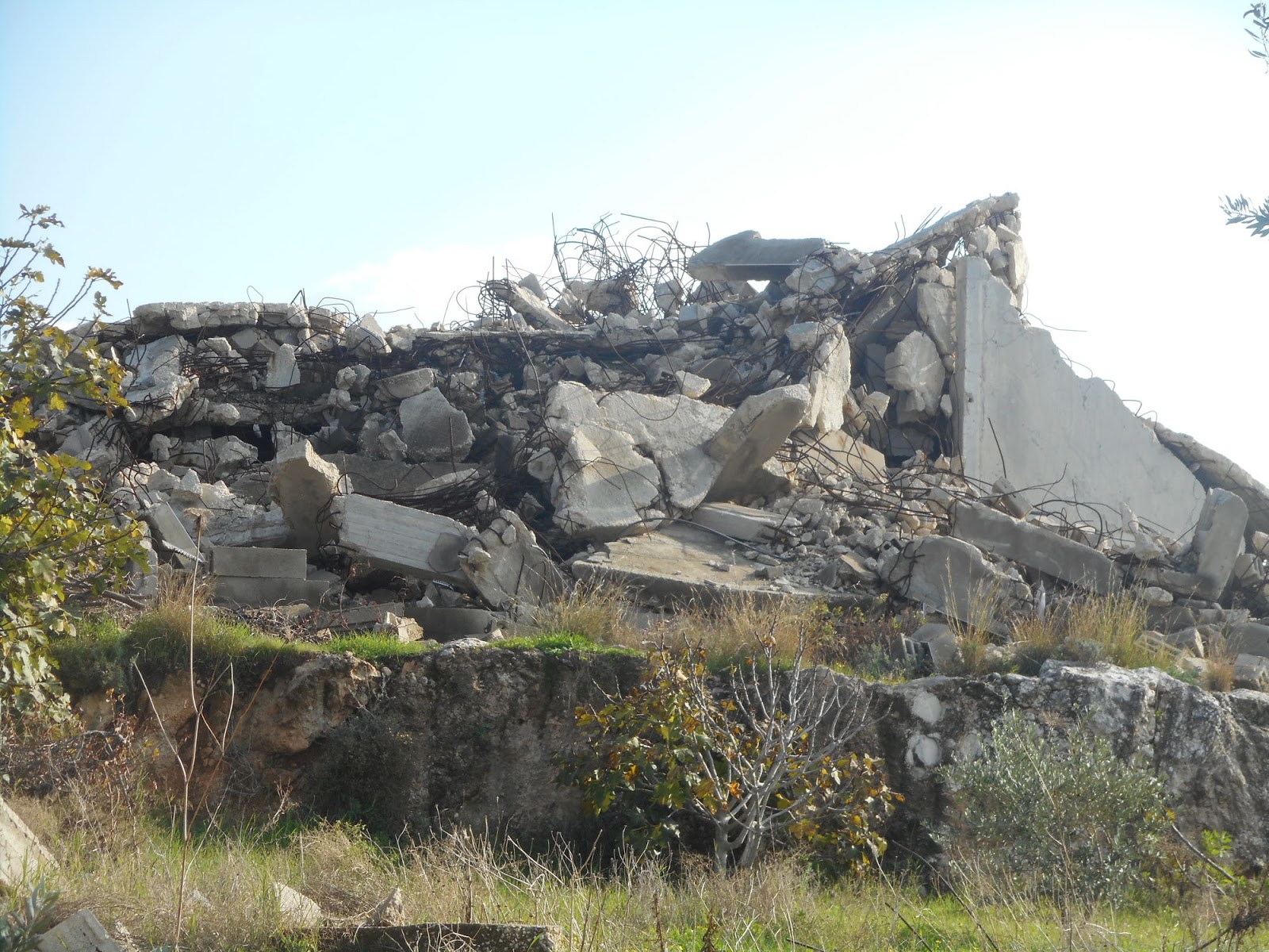
A few demolished homes

map of home demolition in Farun

I tried to collect the data in the village if Farun, I picked Farun not because the situation us especially bad, but because it was small and easy for me to get to.  It is just an example of life in the West Bank. I thought the village offices would have a complete list.  But I found that the Israeli occupiers do not bother with the legal government, they just go to a home and hand them a demolition order.  The legal government only finds out if the landowner happens ti tell them.

To the best if my knowledge none of these demolitions are collective punishment, some are deemed a security risk (too close t the wall Israel put where they wanted to), some seem to have needed a permit, some don't comply with rules Israel created.  As best I could find out there is no way to tell ahead of time if the house you are building will be demolished. Frequently it seems Israel waits until the house is finished before issuing a demolition order. 

Add caption
It is hard to imagine demolishing homes like these


The map has several layer each with a given color pin and a given category of misuse.  All layers may be turned on or off depending on what you want to look at.  In case you can't find the layer side panel:
          red - demolished
          light reddish - demolition orders which have not been carried out yet
          yellow - is denial of use, some times Israel tells a land owner if the stop using a buiding, and don't finish building it or repair it Israel will not demolish it. This saves Israel the bad press of demolitions.
          green - are events like people getting shot which have become part of the culture
          gray - are and marks, these are to help people orientate themselves if they choose to do a self guided tour of Farun.


link to map of house demolitions


12.13.2015

Demolition of houses in Far'un

An example of the taking of land and penning in of communities can be found in the village of Far'un. The apartheid wall was a first step. As can be seen in the accompanying map at places the apartheid wall is placed 3 km inside the green line (1949 armistice line). A friend of ours had 400 acres confiscated when they built the wall.

Then the Israeli occupiers wanted check points so they could examine people and vehicles as they crossed from Palestine into Israel. The checkpoints are often elaborate with large buildings and extensive parking areas, all of which are carved out of Palestinian land. In the case of Far'un the occupiers were not satisfied with one check point, the wanted one that only processed trucks (At Tayba), one that only processed Palestinians (Ephraim), and one that only processed Israelis (Kafrait). See these on attached map


The names of the check points dominate the map At Tayba, Ephraim, Kafriat, the  location is marked with an X in a circle. The bold red line is the apatheid wall.  The dashed green line is the "green line."  About centered is the Village of Far'un, it is shown in a yellowish, brownish color.  The blue area is all Area C (contoled by Israel)

The apartheid wall around Far'un is mostly a fence, but it is an electified fence that has a road and also a buffer zone on both sides so it is about 50 meters wide of cleared and bulldozed land, Palestinain land. If you look at the attached google image you can see that the apartheid wall is the most prominent feature visible and that it is 2 to 3 times wider than the biggest road in the image. Looking at the map you can see they put the wall right next to the village on the south and west sides, which necessitated demolishing houses. Some people say “Israel wants the most geography with the least demography.” In other words they want the most land they can get without getting any Palestinians. What ever the rational one can see the wall cuts right next to the edge of the village, it separates the villagers from the land they own and which has fed their families for generations.


Besides building the apartheid wall they control the land near the wall. For example in the google image on the left side you can see a brown rectangle.  This was the village children's soccer field.  But the occupiers decided it was too close to the wall they had just built so they stopped the children from using it under threat that they would be shot.  In fact a 9 year old girl was shot (2006) on the road near the ball field, shot just for being there.  Adding insult to injury some occupying soldiers drove their jeeps into the ball field spinning their tires and turning tight corners rutting up the ball field. In the village some say the soldiers were drunk. It is hard to imagine how some kids playing ball could be a threat.  It is 100 meters to the area of the apartheid wall which is 50 meters wide and another 150 meters to the closest Israeli structure which is a fortified military base. Can the soldiers really be afraid of a child playing socker 300 meters away?


Houses and structures near the apartheid wall have been demolished and continue to be demolished.  As an example a family with 4 sons and one daughter worked for 11 years to build a house for the family, but when it was completed the occupiers demolished it (in 2014).  Not only did it put 7 people out of a home but the shock and grief caused the father to die.  The houses on both sides of this house were not demolished even though they were closer to the wall.  There is not some map or a way the residents can tell if their house will be allowed. They build on their land after years of planning, saving and work.  When the house is finished they are told it will be demolished. We do not know how many houses have been demolished, but we visited many that were rubble.  There are about 12 in the village that are currently scheduled for demolition.

It all seems so irrational.  In a large section of land on the southwest of the village (lower right of google image) no farming or activity of any kind is allowed, yet right close to the wall surrounded by this no use area a greenhouse and small field next to it is allowed (see photo).

These green houses are allowed.  The apartheid wall can be seen in the upper left. All the land behind the green house, to the right of the green house and in front is not allowed to be used even to pick olives.


At another spot a new farm has been scheduled to be demolished including the little new fuit trees.

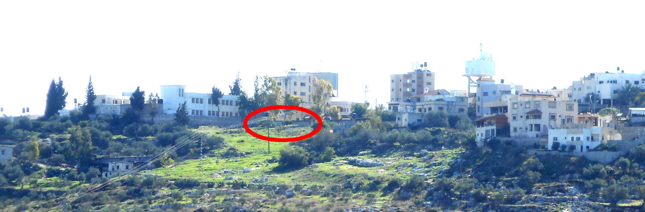
On the north and east side of the village there is no apartheid wall, but here it is Area C, over which the occupiers claim complete control even though they acknowledge they do not own the land or the buildings. On the north side of the village a Christian neighborhood was demolished. You can see from the photo that there are houses, which are not schedued for demolition, on three sides of the demolished neighborhood. One half of the girl's school, also on the north of the village, is scheduled for demolition.  In the photo below you can see that it is a continuous wall but that part of it is older.  The old part is scheduled to be demolished.  Another photo shows a pinkish brown 3 story new building scheduled for demolition yet the buildings around it are not scheduled for demolition.

The Christian houses were in the area of the red circle.  The girls school is to the left of the red circle.


The left part of school is scheduled for demolition, the right part is not.


On the east of the village the same thing is happening, see the photos of three houses that are scheduled for demolition. They are no where near the apartheid wall, they seem to pose not imaginable threat to anything.  These are just new family houses being built as anyone would on the family land after years of planning, work, and pride.


We visited another category of buildings which are not scheduled to be demolished but only because the owners have agreed to stop construction, or repair, and to not use them. These do not appear as part of the numbers of demolitions, but still the work, investment and hope has been stolen from the family.

We visited a building which used to be home, but the family was told they had to move out or it would be demolished (2006).  In 2010 Israel gave them permission to convert it from a home to a wedding hall and as such it would not be demolished or at least not now.  This building is in the village and surrounded by other buildings which are not under orders to be demolished.

The Village of Far'un is just one example, there is nothing saying this village is to be eliminated yet is subjected to continued demolitions and denial of use of their land on all four sides.

12.04.2011

A busy day in and around Hebron

Any day for an activist in the West Bank can include a surprise or two. Our day in the Hebron area was full of unscheduled action. We had just spent the night with the Christian Peacemaker Team deep in the old city. We arose early to go on check point watch with CPT. This is a daily pre-breakfast task for CPT. Critical check points are monitored to log the number of school children passing and to observe the treatment of others. One MPTer decided to take pictures and chose to continue even after a soldier said “No”. The police arrived later. Police have more authority over internationals. After manipulating the memory card out of the camera and passing it off (a move the soldier unfortunately observed), the camera was handed to the policeman. It could have gotten messy at that point but up rolled a car with TIPH representatives. TIPH, Temporary International Presence in Hebron, is a creation of the Oslo Accord. They observe and file reports – no more, no less. But the Israelis want good TIPH reports. It is our guess that their arrival prompted the police commander to get out of the vehicle and take charge. The camera was immediately returned and MPTers moved out of the way. The soldier and policeman were upset at being overruled. MPTers were relieved.


This is the check point we observed. The soldier is asking us not to take pictures. School children have to pass through the little white building for metal detection and such. These four men are being checked as they complain that they were just checked at another check point to get into this area (True according CPT staff.)


Then a call came alerting us to a home demolition south of Hebron, in Baqa Valley. A quick trip to the CPT house to repack, a taxi and soon we were at another scene. Somewhere in there breakfast got forgotten.


By the time we arrived in Baqa'a the Israeli army had already destroyed a well and a house built next to it, both of which belonging to a local Palestinian family. Baqa Valley located in a mountainous area south of Hebron. It's separated from the notorious Jewish settlement of Qiryat Arba only by a road. The village suffers serious water shortages and locals have been accused of "stealing" water from the settlement in order to meet their basic water needs. Naturally it's arguable if one can steal their own water but that's the pretext under which the Israeli army destroys wells and irrigation pipes belonging to Palestinians in Area C. We were told that one more well in the village was to be destroyed on the following day for the same reasons. This particular family had their well and house destroyed for the first time in 2009. The reason was actually the usual one: lack of permit to built. Their water did come from pipes from a neighboring village. After 2009 the owner rebuilt both his well and home and acquired all the necessary documents proving that the land is his. It was to no avail though, the bulldozers returned.


When MPTers arrived the bulldozers were leveling the ground. The Israeli army was working along with Qiryat Arba settlers to place stones on the property to minimize the chance of rebuilding. We were told by children from the family whose home was demolished that the bulldozer has been at work since 6 am. That's when the family had been awoken from their sleep and given 5 minutes to leave.


The only hint for the existence of the house and the well at this site hours later was the water flowing now all over the place. An MPTer asked a boy from the family why he wouldn't change his pants that were wet. He replied he was beaten by an Israeli soldier earlier during the day and now he had no house to take a spare pair of pants from. His parents were at his uncle's house at the time and were sparing themselves the sight of the bulldozers at work.


We had planned to visit the village of At Tuwani on this day so after watching the home demolition clean up, taking pictures, and talking with the family and other internationals, we decided to go to At Tuwani from this new location. MPT has a history of visiting At Tuwani. You can learn more about this village by reading our old blogs.


This report talks about the Bedouins in Tuba, a village very near to At Tuwani. http://mptinpalestine.blogspot.com/2008/05/bedouin-land-fragile-desert-ecology-and.html And in 2009 MPTers visited again. http://mptinpalestine.blogspot.com/2009/11/cactus-watering-protest-at-at-tuwani.html


Children from nearby villages are still accompanied by internationals and the military as they walk between the Israeli settlement and Israeli outpost on their way to and from school. This is necessary because the settlers have a history of attacking kids on their way to school. We were reminded of President Obama’s recent speech where he commented that Israeli parents should not have to worry about their children when they send them to school. He made no mention of Palestinian kids on their way to school.


The settlement of Ma'On is on the hill. New construction is visible to the left. We are not able to see the Israeli outpost hidden in the trees to the right. International volunteers are not allowed to escort the children, this is considered as a "provocation" by the settlers and the Israeli army. So they only observe from afar trying to make sure the children are escorted safely from various observation points on the hills around the area. The army comes twice daily to provide escort as the children walk to and from school, often late and without completing the whole route. That day they came after the international volunteers had contacted the local DCO, only half an hour late. The children actually rejoiced at the sight of the approaching jeep, they could finally goo home now. Sometimes the soldiers actually provide protection when trouble starts .... sometimes.
Another informal taxi ride and a group cab got us back to Hebron for the another evening with CPT